Last of Utah’s Mighty Five

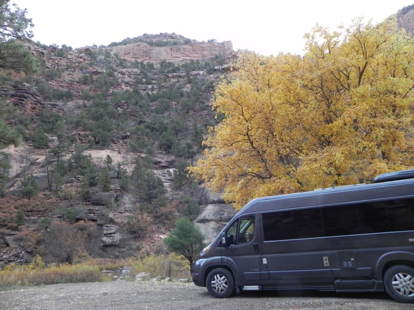
OK, so we give up.  We spent two nights in Bryce Canyon NP and on the second night the temperature slid into the teens and our water lines froze.  Decided to skip Escalante Staircase and Kodachrome SP and headed down  south to Zion.

Highlights of Bryce:

  • the ride into the park along scenic Byway 12, America’s first All-American Highway, beneath Red Canyon’s bright red cliffs and through two tunnels
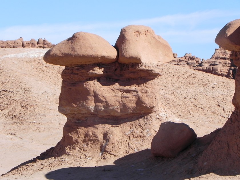
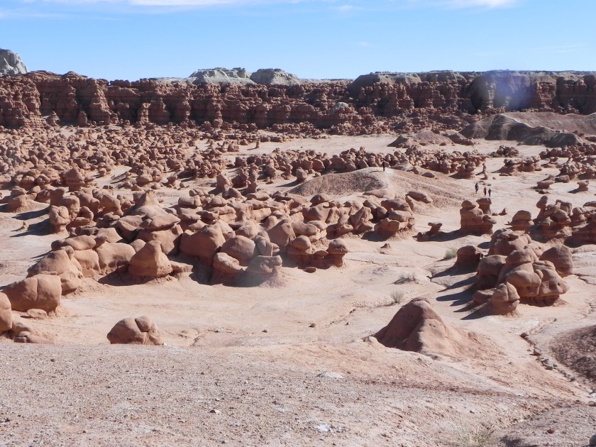
  • the road to Rainbow Point and its many pullouts and vistas, including Bryce Point overlooking haunting spires and hoodoos, wishing I were 20 years younger so I could take the Under the Rim trail and look up at them instead of down
  • dinner at Ruby’s, a Bryce Canyon institution, dating back to the early 1900s
  • taking a walk to Piracy Point (never did find out where the name comes from), a short trail that led to the edge of a cliff without barriers to speak of.  Made Ron a little nervous.
  • coming face to face with one of the many ravens we’ve seen on this trip at the Natural Bridge overlook.  This one reminded me of the “gladiators” at the entrance to the coliseum in Rome, elegantly posing for photos and then demanding payment (we didn’t feed  him, though)
  • not such a highlight but a memorable moment nonetheless: when we arrived we circled the campgrounds as usual, looking for just the right site – this being November, there were quite a few. We pulled into #23 which did have a tag but it read 5/11 so we figured it had been left behind by a spring visitor and the campground host was too busy to notice and pull it.  There were no other signs of it being occupied – no chairs, no lanterns left behind –  so we settled in for two nights. The next morning the host tapped on our window to let us know that the site was indeed taken by a Canadian couple who used the European convention of writing dates – first month, then day. Ooops. She was gracious and so were they when we went over to apologize but we were so embarrassed.  Oblivious Americans, all.

Highlights of Zion:

  • finding out the shuttle bus was still running and being able to park near the visitors center to board it. And finding that, while not nearly as crowded as when we first drove through in September, Zion is still a pretty busy place in November.
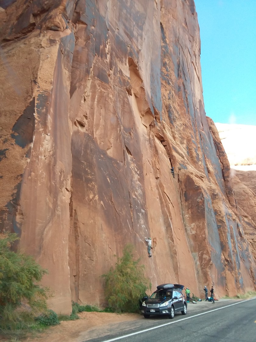
  • seeing a rock climber over 300 feet up on a cliff face, hauling what looked like a duffel bag of supplies up with him, maybe to spend the night at the top?
  • taking a short walk on the Grotto Trail and walking right by a mule deer munching on the grass behind a brush pile
  • learning how the Mormon settlers that followed Brigham Young to Utah named the peaks and cliffs in the area referencing the bible – the Three Patriarchs  (Abraham, Isaac and Jacob); the White Throne; Angels Landing and more.
  • realizing that another hotel stop was what we both wanted and choosing Flanigan’s Inn and Wellness Spa right outside the park instead of a generic motel to rest.  Very lush, very comfy, very warm.

Tomorrow we continue heading south.  When we first planned our cross-country saga we thought we’d be escaping the cold, but it turns out almost all the places we have wanted to see were in the mountains, and the mountains in the fall are darn frigid.  But enough is enough and tomorrow we head for the desert to spend our final weeks before going home for the holidays.

Geology and Archeology, oh my!

We knew there would be a lot to see in Capitol Reef so we booked three nights in the Fruita CG.  Although the orchards were bare, the Gifford House had plenty of fruit pies.  The house itself is a restoration of  what was once a meeting place for the Mormon families that settled this part of the Fremont River and planted thousands of fruit trees for themselves and for trade. We bought an apple pie and headed to the petroglyph viewing site to catch a lecture.

Rick, a volunteer from Colorado, gave an amazing talk about the Fremont Indian culture explaining what distinguished them from the pueblo cultures further south and how to interpret the petroglyphs and pictographs they left in this area. These native Americans lived on the Colorado Plateau along the Fremont River  for about a thousand years, then left for unknown reasons at about 1350 CE. The current Hopi and Zuni tribes of the southwest consider them the ancient ones, ancestors whose beliefs and traditions are kept alive through oral histories and ceremonial practices even today.  They were master basket makers, grew corn, squash and beans and lived in relatively small family units, in pit houses that were situated near their fields. Their pottery was built from coiled clay and rarely decorated like Navaho pots but their rock art depicts anthropomorphic  figures who wore headdresses, necklaces and ornate belts.  They also left unfired clay figures similarly decorated. Fascinating and made us eager to learn more.  We’re planning another side trip – this one to the Fremont Indian Museum and State Park about 70 miles north of Capitol Reef – once we leave the park.

On our way back to the campgrounds we spotted turkey in one of the orchards and stopped to check them out.  Just a little beyond the birds Ron saw what looked like a dog sleeping in the grass,  but when it got up we could see it was a coyote.  Confirmed our identification with the ranger before heading back to the site. As an aside, the campgrounds is loaded with mule deer who pay no attention whatsoever to the human visitors all around them.  One large male rounded up his harem and began to challenge a younger male nearby.  They butted heads half-heartedly for a few minutes before returning to their evening meal.

The next day we took the scenic drive to Capitol Gorge.  A little bumpy and 10 miles one way but worth it.  Just when you think you’ve seen every rock formation possible there’s a different one around the bend. Apparently, as we learned the following day at another program, Capitol Reef was protected only because it contains a true geologic oddity; a monocline that stretches north to south,  from one end of the park to the other.  According to  Jamie, our ranger presenter, monoclines are formed when one tectonic plate (in this case the Pacific plate) goes under another (the North American plate here) and pushes it upward, thrusting millions of years of sedimentary rock layers higher on one side than the other.  She made the process perfectly clear, but memory being what it is, the details elude me.  But we did buy a book with lots of pictures, captions and graphs so we can figure it out later on.  I hope.

Left Capitol Reef heading for the Fremont Indian Park on Sunday.  Stopped for a picnic lunch in Fishlake National Forest, on a short spur that had been part of the Spanish Trail, a pack trail that wends its way from New Mexico to California. First used by native Americans then Spanish missionaries and finally frontiersman and prospectors, it was heavily used until the late nineteenth century when more direct routes were established.

Overnighted in the Castle Rock CG, a lovely part of the state park, and visited the museum the next day.  Did some more Christmas shopping at the park store and learned more about the Fremont culture. The volunteer at the desk gave us directions to the nearest laundromat, 30 some miles away in Joseph, so off we went to do a marathon wash and dry. And not a moment too soon as the jeans are beginning to stand up by themselves.

Bryce Canyon NP is our next destination after a much needed shower stop on the way.  Ron found a lovely B&B, the Panguitch Guest House, halfway there run by Kim and Rod Quarnberg.  Comfy, warm and welcoming, a respite from the cold.  We may just breeze through the next three parks and head south to Nevada sooner than planned.

Canyonlands, Arches, and more

Moab must be a Mecca for mountain bikers.  Beginning a couple of miles out we started seeing signs for bike trails, bike rentals, bike tours – not to mention all the bike racks on pickups, RVs and just plain cars. Even our motel (the Red Rock Inn, where we stopped for showers and laundry) had a bike washing station – no car washing allowed. We had dinner at the Blu Pig  (BBQ and country music) and spent a restful night. Ron made it to the 14th inning of what turned out to be an 18 inning World Series game.

The next morning, we had breakfast at the Jailhouse Café before setting out for Canyonlands NP.  All the way up to the Horsethief CG (BLM land) we saw bikers by the truckload at each trailhead.  In the campground itself there were families of bikers, with young kids practicing their sport wherever there was dirt. We spent the afternoon driving through Canyonlands scenic canyons, stopping for a picnic just before the end of the road. We decided to stay another two nights, changing our site to a more level, prettier site we had seen.


On Sunday we drove into Dead Horse Point SP. The legend goes that some cowboys drove a herd of wild horses into the end of the butte, blocked the only way out, selected the ones they wanted and left the rest without food or water, 2000 feet up from the river below. The horses are said to have died looking at water they could not reach, thus the name.


Monday was our day for seeing Arches, another one of Utah’s Mighty Five. We picnicked just past Wolfe’s ranch.  Wolfe and his son left Ohio for the warmer, drier air of the Utah desert and lived for nearly a decade in a one-room log house, raising a couple of cattle and growing corn by the side of a small creek. Nearby was a wall of rock art, the first we’d seen close up.  Eventually his daughter and her family joined them but didn’t like the remote area and all returned to Ohio eventually.


Continuing along the scenic drive for the better part of two hours,  we checked off most of the highlights of the park: Balanced Rock, Delicate Arch, the Windows, etc.


DSCN2870
At THE Balanced Rock. (Many more nearby,)

DSCN2858

DSCN2880
North window

DSCN2879

On Tuesday morning we went back into Moab to camp near the Colorado River at Goose Island and set off to follow the rock art trail.  It was like a treasure hunt, following directions and scouting for the petroglyphs left behind by long ago inhabitants of this area, some now surrounded by a golf course community with million-dollar houses right nearby.  After a nice lunch at the Moab Brewery we continued our quest.  Driving down SR279, we couldn’t help noticing dozens of cars parked along the roadside. Turns out, it is also a rock-climbing hotspot. We watched in awe as pairs of climbers, one ascending one holding the safety line, climbed what looked like a sheer vertical rock-face.  Had to send a picture to Emmett and Cal.

20181030_154112.jpg


We left the Colorado river behind and drove to Green River, visited the river museum and turned west again for Capitol Reef NP, the next one on our agenda. On the way to Capital Reef we camped at Goblin Valley SP, perfect timing.  It was Halloween and the goblins in the valley were only a short walk away.


DSCN2945
Goblins stand guard.

DSCN2933DSCN2950DSCN2934

DSCN2930
Valley full of goblins….

The only wildlife we saw was a red tailed hawk, sitting about 100 feet from our camper on a small sandy mound, holding his dinner with his talons. Looked like he was having snake or lizard for his meal.

We left Goblin Valley at 10:30 and arrived at Fruita CG in the park about two hours later.  It’s fall here in the Fremont River Valley; all the trees are shades of gold and yellow, a bright spot in the unrelenting high desert landscape. We booked the site for three nights and will explore the park until Sunday.


Mesa Verde to Moab

We said goodbye to Mesa Verde after three nights in the same campsite – most unusual for this trip and a welcome rest from going, going, going. But we didn’t drive too far.  Just north of Cortez, the next town down the road, we decided to follow some directions in our free/low cost camping book and wound up in Bradfield CG in the Dolores River access area.  Pretty, but we thought we were headed for a campsite called Mountain Sheep Point, also on the Dolores River, so the next morning we decided to try to find it.

We did find the river access signs we were looking for and drove through farmland on dirt roads until we reached the entry to the BLM land where the camp was located.  Now we have definitely tested the boundaries of what the ZIon can do, driving over mountain passes, going miles on unpaved roads but nothing compared to what we did here.  The road into the canyon was steep and winding, barely wide enough for the van to drive on and pretty much covered with fallen rock.    At least a dozen times I said we shouldn’t be down here but there was absolutely no place to turn around.  One side dropped down into a creek and the other into rock filled ditches.  With hearts in throats we finally reached the river at the  bottom and pulled into a gravel-covered circle, barely big enough for three or four cars, with a sign saying Mountain Sheep Point.  Although it was early in the day we turned off the van and declared our intention to stay the night, postponing the  inevitable trip back up the canyon. It seemed from the limited signage that these campgrounds on the river are for the use of kayakers and rafters, with pullouts and launches marked but not the roads.  But it was beautiful and silent; the only other vehicles that passed through was an ATV late in the afternoon and a jeep that drove the loop the next morning then disappeared back the way it had come.

DSCN2787


DSCN2789
The Dolores River canyon at daybreak.
DSCN2788
The only ones for miles

DSCN2786

We left relatively early to avoid any weekenders that might be coming down the road and drove to Moab for breakfast and a well needed motel stop for laundry and showers before beginning our tour of the Utah Mighty Five.


Cortez, Durango, Walmart, Mesa Verde

Jim at the VLA mentioned a casino outside of Cortez and so we headed to Sky Ute Casino.  Turned out it was WAY outside of Cortez and that we probably misunderstood the directions.  We passed through Durango (for the first time) and wandered south until we found the casino.  Slept, showered and did our laundry before heading back to Durango to see what there was to see. This was a town that lived up to its press as there were plenty of good places to eat, lots of shopping and picturesque restorations, including two 19th century hotels and the narrow gauge railroad that was originally built to take the miners up to the ore and the ore down to the smelters.  We bought tickets to Silverton – bus there and train back – for the next day and found the Lightner Creek campgrounds (wifi, water, dump) for the night.  Chatted with the village for a while and turned in for a peaceful night.

The ride up to Silverton was spectacular, with snowy peaks and ever-changing forests all the way.  Every now and then the original stagecoach road was visible from the highway, and the bus driver recounted the economic  history of the area from trapping and mining to the present day reliance on tourism.  The only road remains open year round despite the heavy annual snowfall, only closing for 24 – 48 hours at a time to clear the way.

Apparently last winter they received about  27′ (that’s feet) of snow at the top. The town itself was interesting; one paved road, a few shops and cafes and not much else.  But walking around brought into focus how isolated the mining towns must have been and how difficult reaching them was.

The train ride back to Durango was scenic; through the canyon, along the Animas River almost all the way.

It took a bit longer than expected but we got back to Durango in time for a nice dinner at the Quiet Lady Tavern.  But first I dragged Ron on a futile quest in the dark to find a choral concert I had seen listed in the October events flier.  We got to the church where I thought it was being held only to find it locked up tight as a drum, so we walked back into town to eat. The tavern was cozy and warm, Ron got the pasta he was craving and then it hit us; we hadn’t made plans for the night.  I was all for staying put in the train parking lot but Ron felt more comfortable going to Walmart, so Walmart it was.  I called to find out if overnight parking was allowed and got an employee who cautioned us that, although it was not technically allowed, if we stayed on the edges nobody would bother us.  So in we went, finding at least three other overnighters already tucked into the better spots near the trees. We found our niche and bedded down for the night.  Despite some late night weed-whacking and a really loud  truck that couldn’t get started the first three tries, we spent another uneventful night in a Walmart parking lot. The next morning we headed back to Durango, ate breakfast in the most popular cafe in town and did a little antique shopping before heading west to Mesa Verde NP.

20181021_111152.jpg

In the morning, another Roadtrek pulled into the spot next to us and we met Barbara and Paul from Seneca Falls NY.  We chatted for a while, then drove to the top of the mesa to see some cliff dwellings.  We thought we were done with ancient ruins but these were in a class of their own.  This area of the country was inhabited for over 700 years with an estimated 30,000 inhabitants, ancestors of the current Zuni, Ute, Hopi and Navajo tribes.   Many of the tribal customs still practiced today can be traced through artifacts and oral history to the abandoned pueblos here in Colorado, in Utah, Arizona and New Mexico. Now I’m sorry we didn’t visit the pueblos in Taos and Santa Fe, or one of the many we passed on the road south through the state, to learn more about the fascinating southwestern native American history. Opportunity lost as we probably won’t be going back that way.

DSCN2764DSCN2773

DSCN2756
Cliff Palace
DSCN2775
Spruce Tree pueblo

We brought some cheese and crackers and Durango brewed ginger ale to the neighboring site and spent some time with Paul and Barbara before the rains came. Exchanged contact info and invitations to visit before they left the next morning and we drove down to the visitors center to update the blog and mail some postcards.


Rodeo and the VLA

We did indeed go to the rodeo in Socorro on Sunday.  Despite twice passing the sports complex where it was being held, it took us a very long time to find the entrance.  But it was definitely worth the trouble.  There wasn’t much of an audience despite it being the New Mexico finals, so we circled the ring and asked if we could join a couple in one of the front row boxes.  They turned out to be the proud grandparents of two of the barrel racing contestants and one of the youngest cowboys imaginable.  Their 5-year-old grandson was the one herding the calves into the chute after they had been roped and released.  He  was so skillful he reminded me of a border collie rounding up sheep.  He would ride his pony right up to the calf and manuever around it until the calf had nowhere to go but where it was supposed to.

Although it was hard watching calves being roped and tied, the skill of the horses was incredible to see. Horse and rider rode hard out of the gate and, once the calf was roped, the horse stopped on a dime and stood stock-still as the rider jumped off and tied the calf’s legs together.  I think the best time was around 12 seconds from start to finish. There was also barrel racing, bull riding and bareback riding.  My first rodeo and, while I don’t think I’ll be back, it was quite an experience.

We returned to Water Canyon CG in the Cibola NF for a second night so we could get an early start the next morning.  Target was to visit the Very Large Array, one of the world’s biggest radio telescopes.  As we parked at the visitors center a man got out of his official vehicle and came over to ask where in New York we were from.  We told him and got to chatting and mentioned Emily’s grad school focus.  He is one of the engineers on the upgrade project that is being undertaken over the next few years and offered to email us pictures from the inside of one of the dishes for her.  We will definitely take him up on the offer; will send his card to Emily asap.

We spent some time at the visitors center, watched a film showing how the information gathered there has contributed to our (not my) understanding of the creation of the universe. A walking tour was available but the 30 degree temperatures and howling winds forced us back into the van.  Curious but not that curious.  As an aside, the weather here in New Mexico has been frightful.  We thought of the southwest as unceasingly sunny and mild but we have experienced winds up to 40 or 50 mph and temperatures below freezing almost every night.  The radio did say temps were 25 to 30 degrees below normal and that it was warmer in the northwestern states than here.  I guess we’ll find out.

We headed west to Dalit Wells CG in the Cibola NF and camped for the night.  $2.50 for the site because it is on Bureau of Land Management lands.  Woke up to another 34 degree morning and headed out to find propane to top off our tank.  But first we had to pass through Pie Town which, it turns out, actually does have a few establishments specializing in pies.  We stopped at the first one called the Gathering Place and had pie and coffee.  Very hard to choose just one – they must have had 20-25 varieties listed and at least a dozen in the case.  We settled on apple to have there with our coffee and blueberry-peach to take with us.  I wish they shipped!

20181016_102352.jpg
How to choose?????
20181016_103644.jpg
The pie makers
DSCN2615
The Gathering Place in Pie Town

Got our propane and drove through blinding snow, 24 miles in the wrong direction.  Retraced our path – still in heavy snow – and made our way to Grants where we camped in the Bluewater State Park.  Awoke to still more snow and gusty winds but, undeterred, drove on to Gallup to start on our next national park quest.


In search of cranes

Diane reported hearing cranes flying over her yard in Loveland about a week ago and other campers in Rio Bravo said they heard them while we were there so we thought we would find them in the Bosque del Apache WLR, their wintering grounds. We drove both north and south loops but not a crane in sight – any day, we were told. We did see a kestrel, N. harrier, flickers, meadow larks, white crowned sparrows, Gambel’s quail, avocets and a red necked (or possibly the more common Wilson’s) phalarope.

DSCN2341

Tired of driving, we tried camping on a BLM dirt road in San Antonio right next to the Rio Grande (again!) but it just didn’t feel right so we took a night at the Days Inn in Socorro to nurse Ron’s cold. After a quick stop at the local Walmart for meds we had a nice dinner at the Bodega Burger company, listening to a local duo cover James Taylor, et al.

The next day, with Ron feeling a whole lot better, we visited Socorro’s Plaza and hit the post office and a coffee shop.  Also a gallery where a picked up a nice giclee print of Sevilletta. Driving west out of town on Rte. 60 we saw a sign for Water Canyon CG in the Cibola NF and decided to spend the night.  Put on the crockpot and hoped the sun would stay out so our solar panels could do their thing.  Worked out fine – the stew cooked, we played cards on the picnic bench in the sun and got into the van just as the clouds gathered and before the rains came.  Planning to return to Socorro in the morning for gas and a possible rodeo.

Sand Dunes to Balloons

We didn’t travel too far after leaving Pueblo.  We’re kicking back a bit – no more six hour driving days if we can help it.  We chose Lathrop SP because it was on the way to the Great Sand Dunes NP, another add on to our national parks tour. It also happens to be the oldest state park in Colorado and the only one with a golf course.  Not that we golf, but it had a club house where we had lunch on the way in and breakfast on the way out the next morning.  Saved us from doing dishes.

The Great Sand Dunes were honestly great. The highest reaches 750 feet above the base – pretty impressive when you see them in comparison to all the people climbing, sliding and just admiring them from the parking lot, looking like so many ants around an ant hill. It was chilly and the wind was blowing pretty hard – like most of the days since we started this leg of our journey – so we took a few pictures and got back in the van.

We decided to go through Taos and Santa Fe to get to Albuquerque for Balloon Fiesta.  Just south of Taos we found a small campgrounds by the side of the Rio Bravo (a feeder of the Rio Grande, which we continue to follow southward) and opted to stay and see Taos the next day, because one just can’t drive past Taos without stopping. As we were setting up camp – which usually means just  pulling up the parking brake and closing some curtains) we noticed the camp host talking to some other campers who had a puppy on a leash.  Turns out the pup was a stray who arrived at the campgrounds with burrs in her fur and cactus spines in her nose.  The hosts took her in and cleaned her up before reporting her to the Taos pet rescue.  Their facility was full, leaving the hosts with a dilemma; what to do with this cutie.  Two of the campers there for the weekend, Ted and Joanne from nearby Santa Fe, fell in love with her and adopted her on the spot.  She’s a well behaved, friendly, calm brown mix (probably has some lab in her) about 3 or 4 months old and they promptly named her Rio.  Rio was well loved by the other campers who donated some of their dog food and doggie toys so that she would feel comfortable and safe.  By the time they left the next day it looked like Rio had been their pet forever.

We spent a couple of hours in Taos the next day, had breakfast and perused a few – pricey – galleries then returned to Rio Bravo for another night.

We spent the following night in old Santa Fe in the Inn and Spa at Loretto, a beautiful, historic splurge hotel where we had a great room and a really special dinner.  Did a little sight seeing there, visiting the oldest church in North America, the oldest house in the west and the Loretto Chapel, with its “mysterious” spiral staircase which, when first built for the nuns to reach the choir loft, had no central means of support. We wanted to bring some things from Santa Fe home to the Rent and Newsies fans but, believe it or not, there wasn’t a single shop within walking distance that wasn’t selling either high-priced jewelry, made-in-China key chains or Peruvian knits.  Not a tee shirt to be found.

There weren’t many choices for camping between Santa Fe and Albuquerque but we did find one just outside of Bernalillo, just short of 20 miles from the Balloon Fiesta site.  We set the alarm for 5 am – yeah, 5 am – and hoped for the best.

I got up at 4:15 and decided it was better not to go back to sleep, so got dressed and woke Ron.  Now this campsite was at the end of a winding dirt road with many steep sides so I spent some of the night hoping we could safely navigate our exit in the dark, without coffee no less.  But Ron made it seem easy, getting us out without a hitch well before our 5:15 deadline.  It was overcast and cool as we drove down I 25.  Google maps told us to get off at one exit while Fiesta signage told us to go to another. We opted to follow the signs and follow the crowd, bumper-to-bumper for two or three miles.  We asked at one intersection and were directed to general admission parking, even though we had prepaid for a different lot.  The guy at the gate let us in anyway, and we parked and boarded a school bus shuttle which wound its way through Presbyterian hospital parking lot to a bluff above the site by 6:15 – still pitch dark.  A golf cart took us to the bottom of the hill where we caught glimpses of one balloon being inflated, and bought coffee and Indian fry bread for breakfast.  Hundreds of people were milling around in the dark and some folks were laying on the grass on blankets as we picked our way forward, not knowing exactly what to expect or where to go. At about 7:00 am the Wells Fargo balloon flying an American flag led the ascent while the Star Spangled Banner played over the PA system.  After that it was non-stop as balloons were filled and given the go ahead to take to the sky. We watched in awe at daybreak as hundreds of balloons rose and sailed upward, one more brilliantly colored than the next.  What a sight!

dscn2321

Because it was “children’s day” many character balloons joined the array – Kermit, Tom and Jerry, Pepa Pig, Darth Vader, various cartoon animals and birds.  We watched as Owlbert Einstein (a well-traveled rig) was filled and held in place by a crew of about 12.

Toward the end of the morning, balloons began returning to the field, some to take part in the day’s competition: putting a ring around an upright post in the center of the field.  Only a very few were able to navigate the course and triumphantly ring the post as the crowd cheered. Satisfied and getting tired, we left at about 11:30,  only stopping for a few minutes at the Sevilleta wildlife refuge to learn a bit more about the area, its flora, fauna and history.

We got to Escondido Lake, a  Socorro county park,  at about 3:00 pm and packed it in.


Respite from the road

Got up early the next morning and watched a 90 car freight train go by. Then we headed to Laramie, stopped to walk a wildlife trail but only saw a couple of chickadees and a magpie. Down the road a bit was an enclosed field with a sign that said “do not feed or touch the animals”.  It turns out the animals in question were two bison, grazing nearby and ignoring us completely. We got to Laramie soon after and had burgers at Born in a Barn (a cowboy themed lunch spot right at the edge of town)  and watched another a long train go by, this one right in front of our parking space.

We got to Loveland later that afternoon and spent a few days with our friends Diane and Jim Kristoff and their cocker Buffy.  Highlights included:

  • Birding all day Tuesday with Diane and seeing a golden eagle being harassed by two peregrine falcons. Also counted about 150 western grebes on a reservoir and 12 or so bushtits in a stand of rabbit brush. Went out to dinner where Ron tried bison steak.  He was unimpressed.

DSCN2213

  • Ron’s Wednesday fishing expedition with Jim on the Poudre River; he caught three trout (and released them, of course). He also got a good look at an American Dipper. When it first hopped out of the water he thought it was a fish jumping, but when it landed on a rock just across the stream he realized it was actually the bird.   And meanwhile, while birding with Diane,  I got to see another golden eagle flying only about 50 feet above us.


  • Thursday we drove up to Rocky Mountain National Park. The weather forced us to turn around before reaching the Alpine Center at the top.  Not only was the wind blowing fiercely – gusts about 30 – 40 mph, we estimated – but it poured rain on and off as we ascended.  When we noticed a few snowflakes mixed in, we decided to turn around and go back.  Took a couple of side trips on the way down, including a parking-lot picnic in Hidden Lake picnic area while the rain pelted the car, a quick look at Bear Lake and a walk to Sprague Lake where we nearly got blown over by the wind.  We stopped (along with a dozen other cars) to gawk and take pictures of a huge elk bull and his harem of 18 cows.
  • We said goodbye early Friday morning. Diane had to take Jim to Denver to catch a plane to visit his parents in Pennsylvania and we needed to do some shopping before getting back on the road. We let Buffy out and locked up before heading out about 8:30 am.  Had a little breakfast in Mimi’s Café (where we’d eaten the night before) and hit the Skechers outlet to replace Ron’s falling-apart canvas slip-ons.

We camped for the night at Juniper Breaks CG in Pueblo Lake SP just outside of the city of Pueblo.  It was 84°F when we pulled in at 4:30 but the wind kicked up when the sun started to go down – gusts up to 50 mph according to the weather app – and the temperature dropped 20+ degrees in a matter of minutes.  The van rocked and rolled for a couple of hours but we felt cozy and safe inside. We’re heading to see the Great Sand Dunes in a day or two, before driving south into New Mexico.


The long way to Colorado

We got up to a misty, foggy, cool morning and lounged in the van until almost 10 when we backtracked a bit to visit the Big horned sheep information center to learn a bit about these fascinating critters.  On a white board at the entrance to the building they had listed sightings of a number of sheep newly down from their summer grazing grounds so we got directions and took off.  Two hours of searching, driving up and down a gravel and rock road in the refuge and we came up empty.  Not one sheep was sighted.

DSCN2082

Disappointed, we headed for Sinks Canyon SP, overlooking the Popo Agie River and spent the night; altitude 6750 feet and 69°F when we pulled into camp.  By the following morning it had dropped to 36° and the fog had descended.   Undaunted, we drove back to town, did some food shopping, dumped our black and gray water and spent a few hours at the Pioneer Museum.  We learned a lot about the way the pioneers – the ones that survived the journey – lived, worked and worshipped.

We spent the night at another Wyoming SP, Tough Creek CG in Boysin SP just outside of Shoshoni, part of the Wind River Indian Territory.  On our way into the campground, two pronghorns ran away from the road, full tilt towards the lake.

After spending a windy night along the reservoir we decided to take a detour to Thermopolis where there is a world renowned dinosaur research facility and exhibition.  The drive to the center was one of the most beautiful we have yet taken, through canyons along the upper Wind River.  Many cliffs were identified with signage giving the age of the rock formations, ranging from 50,000,000 to 500,000,000 years old. The center itself is an amazing place with exhibits that trace the evolution of life on earth from the first one celled life forms through the age of dinosaurs. Fossils from around the world are on display along with detailed explanations of the creatures lives and habits and where they fit into the overall arc of prehistory. Wound up going back to Tough Creek for another night.

DSCN2139

The next day we set off for Casper, sighting a couple of small groups of pronghorns, about 50 total, on the side of the highway. We got to Casper but there was not much we wanted to get out of the van for – too cold! So we grabbed a cup of coffee at the Metro Coffee shop, texted Emmett, and hung out, getting warm and revising our plans.

DSCN2124

Although we wanted to have a steak dinner in Laramie tonight, we had to settle for left- over pork roast in Wheatland city park, free camping right next to the railroad tracks. There was only one other site taken when we got here, but they kept coming until all six sites were filled. The people next to us were full timers, working for National insurance and going wherever needed.  They travel with two dogs and two cats.  On the other side we met a couple who are on the road three months out of the year, selling leather goods at state fairs and festivals.  They told us they were headed to New Mexico for the hot air balloon festival next week.  Sounds like a great idea! I think we might do that, too.

Before getting into bed we called Diane and made plans to get to Loveland tomorrow.